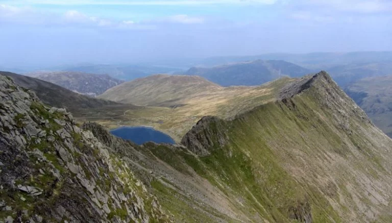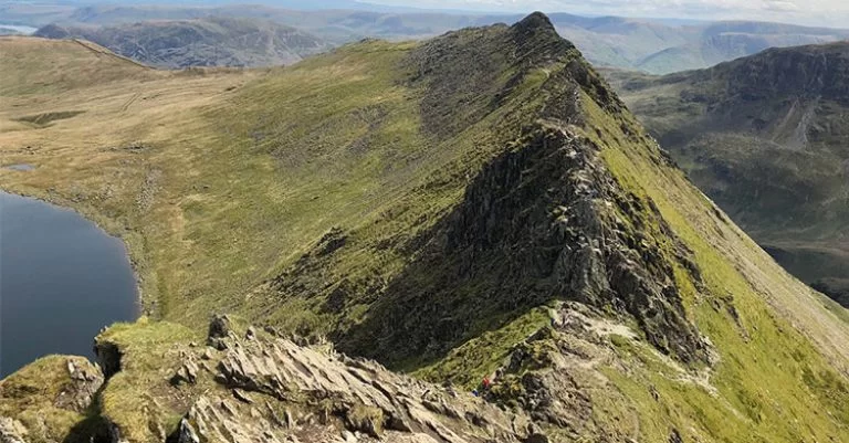
Helvellyn is the third highest mountain in the Lake District and England. The world-renowned peak forms the apex of Alfred Wainwright’s Eastern Fells and Helvellyn walks were voted Britain’s most popular walk in 2018. The mountain has five ridges, therefore there is several routes up to the peak. The far eastern side of the fell is distinguishable by two dramatic ridges which are the most popular routes up the mountain, Swirral Edge and Striding Edge. Helvellyn is classified as a Birkett, Historic County Top, Munro, Furth, Marilyn, Wainwright, Nuttall and a Hewitt.
How High is Helvellyn?
Helvellyn is 950 metres or 3117 feet high.
How long does it take to climb Helvellyn?
To climb Helvellyn it takes around 6-7.5 hours. The quickest route up the mountain is from Thirlmere, the longest route is from Glenridding up Striding Edge.
There are three main routes to climb up Helvellyn Mountain:
- Striding Edge
- Swirral Edge
- Thirlmere

Where is Helvellyn?
Coordinates: 54.5268° N, 3.0172° W
Helvellyn is located in the Lake District National Park and UNESCO World Heritage Site in the North West of England. The fell lies between Ullswater, Thirlmere and Grasmere and to the north of Ambleside. Situated between Thirlmere and Patterdale, Helvellyn can be climbed from starting positions on the shores of Thirlmere or Ullswater.
Helvellyn Walks for Wainwright Walkers
“…a classic ascent recorded and underlined in the diaries of all fell-walkers” Alfred Wainwright
The mountain is one of the Wainwright Fells. When reaching the summit of Helvellyn, walkers following Wainwright’s guides will enjoy sights to of the Scafells, Skiddaw, the Coniston Fells and the ridge of the Eastern fells which explores alternative Wainwright walks like Dollywaggon Pike.
Wainwright describes how different the range’s less steep western slopes contrast heavily to the mountainous crags and edges on the east of the mountain. He commented, “the smooth slopes curving up from the west break abruptly along the ridge, where in complete contrast, a shattered cliff of crag and scree falls away precipitously eastwards: here are the most dramatic scenes Helvellyn has to offer” (Wainwright, 1955). Red Tarn is a popular site for Wainwright Walkers to set up camp.
Julia Bradbury takes the Wainwright route on Helvellyn Walks
Helvellyn Walking Routes
1. Striding Edge – Helvellyn Hiking Loop from Glenridding
Time: 4-5 Hours
Distance: Around 8.5 miles / 13.5 kilometres
Elevations: 2,700 ft
Ordinance Survey Route Map
Helvellyn is the third highest mountain in England, known for its unique route, Striding Edge. Striding Edge is regarded as one of the best hikes in the UK. Helvellyn via Striding Edge is a 13.5 kilometer loop trail starting at Glenridding in Cumbria. The views as walkers elevate up the ridge are amazingly beautiful.

Is Striding Edge a difficult hike?
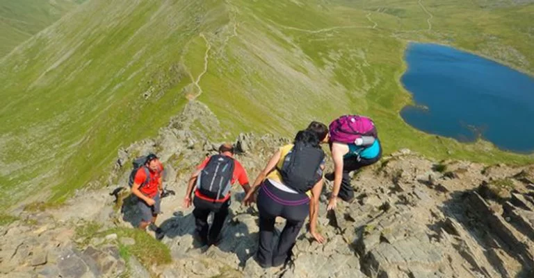
Striding Edge is a Grade 1 Scramble in the Lake District. Therefore, the Striding Edge route is a challenging walk even for advanced hikers due to hazardous terrain along the way on the steep ridges.
Is Striding Edge dangerous?
During poor weather the mountain path can be dangerous so is often avoided by novice hikers in winter for safety reasons. Striding Edge isn’t considered highly difficult or narrow, but it is exposed to strong crosswinds and can be dangerous in winter. There have been several recorded deaths from this route so caution and care is advised.
Parking: CA11 0PD. Visitors can access a Pay and Display car park in Glenridding. Free parking can also be found along the Greenside Road.
Public Transport: The 508 bus is accessible to Glenridding from Penrith all year round. During the summer, the 508 is rerouted to Glenridding from Windermere via Kirkstone Pass.
2. Swirral Edge via Catstye Cam from Glenridding
The Swirral Edge route up Helvellyn is another Grade 1 scramble in the Lake District. To reach the summit on this route, visitors can also venture up another English fell, Catstye Cam. The passage starts in Glendrigg, up Catstye Cam, before finally reaching the peak of your final destination. Many hikers also choose to descend down this route too. On the Swirral Edge path, walkers can also initially avoid Catstye Cam and visit Red Tarn when the way splits within the valley. The views along this passage are splendid, with an array of valleys and streams across the landscape. If you’re planning to do this hike, remember that the Helvellyn walks can be dangerous in bad weather conditions, so take extra care.

Parking: CA11 0PD. Visitors can access a Pay and Display car park in Glenridding. Free parking can also be found along the Greenside Road.
Public Transport: The 508 bus is accessible to Glenridding from Penrith all year round. During the summer, the 508 is rerouted to Glenridding from Windermere via Kirkstone Pass.
3. Helvellyn Walks from Thirlmere
The valley of Thirlmere is known for its sizeable reservoir that serves as a water supply for Manchester. The much-loved tourist area is surrounded with mighty fells such as Helvellyn, Skiddaw and Blencathra. Dunmail Raise to the south of Thirlmere is renowned as the dividing boundary between the north and south Lake District. The famous cairn of Dunmail Raise is alleged to be the burial place of King Dunmail (945AD), the last medieval monarch of the kingdom of Cumbria. Thirlmere is one of the premier picturesque landscapes Lake District.

What is the easiest route up Helvellyn?
Thirlmere is considered the easiest route to climb Helvellyn. The approach up the mountain from Thirlmere is considered much easier than the aforementioned journeys. Hikers climb the shortest route up the mountain via Helvellyn Gill and Lower Man to the summit. Alternatively, walkers can venture over Nethermost Pike and Dollywaggon for a longer circular route.
Parking: CA12 4TW. Swirls Car Park, which is free.
Public Transport: Bus 555 from Kendal to Lancaster City Centre, via Grasmere, Ambleside and Windermere.